
Drone-mounted Pollution Detection
The Industrial Park and the Complaints
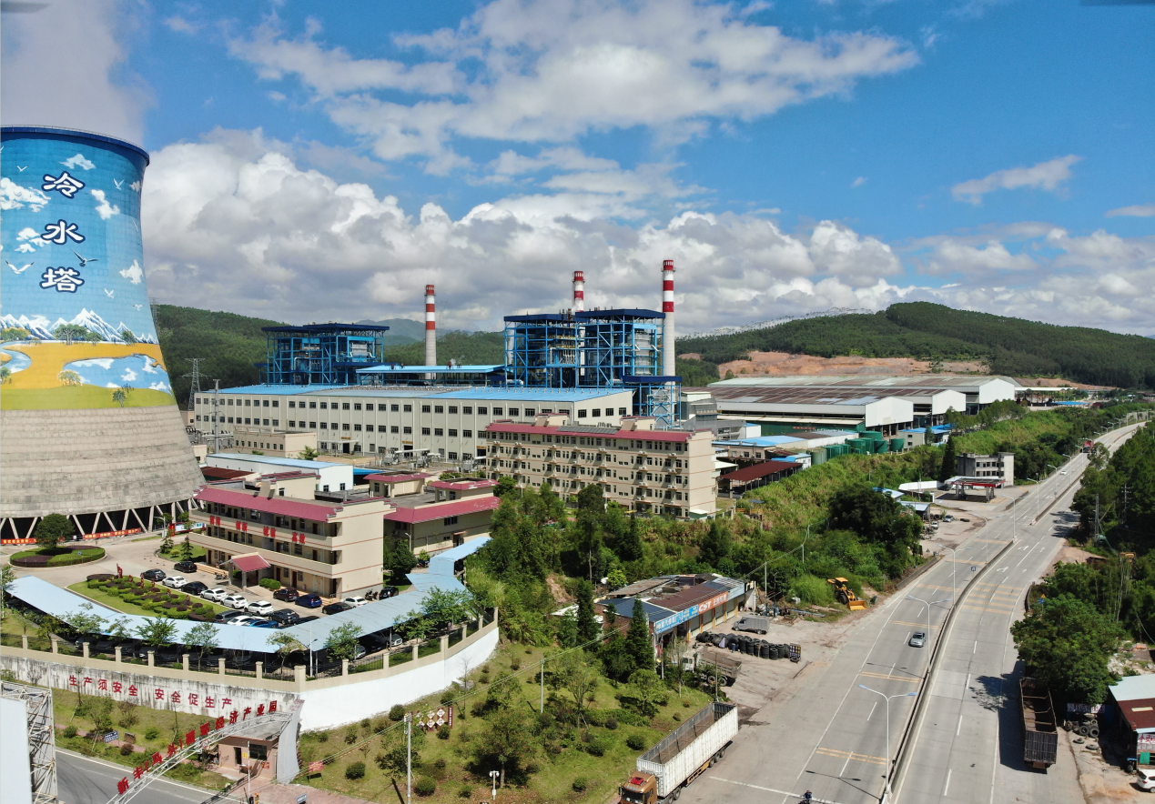
The Status of the Industrial Park
There is an industrial park that focuses on new energy and eco-friendly coatings in a small town in Guangdong province. Currently, there are 19 enterprises, mainly coating factories and new energy bio-power plants inside the park. The fuel they use is derived from the agricultural and forestry biomass fuel within 50 km from the factory and the urban wood waste within 200 km from the factory.
Complaints from the Residents
There are living areas such as central street, middle school, restaurants, hotels and residential buildings densely distributed within 2 kilometers from the industrial park. The nearby residents have complained that they smelt odors similar to the rotten egg and NH3, hoping that the local EPA would take action and deal with the issue.
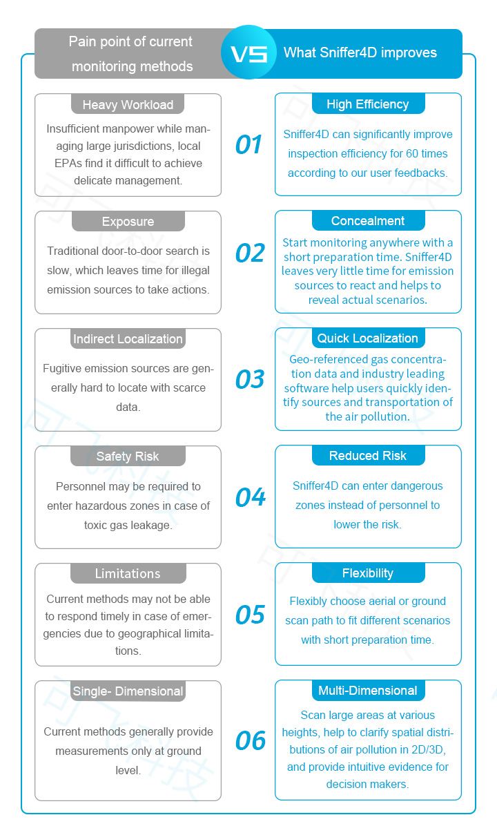
Paint Points of the Traditional Inspection
1. Multiple complaints and door-to-door surveys fail to locate the source.
2. Low efficiency in manual inspection. It usually takes 3 to 4 people to finish monitoring the entire area and at least 30 min to inspect an individual factory.
3. There are places where cars can not reach and blind spots for manual inspection.
4. It is difficult to conduct the inspection at night.
—— Solution Configuration ——
Hardware Configuration
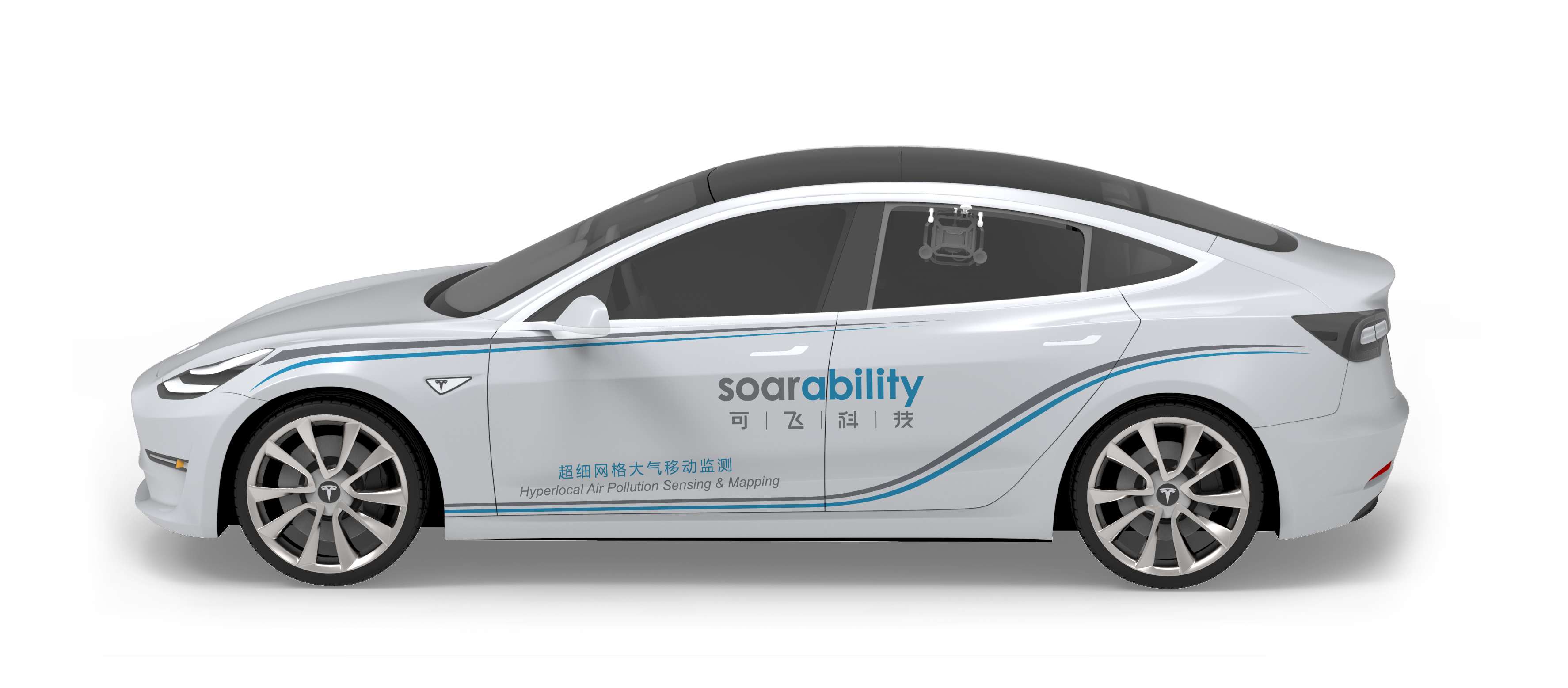
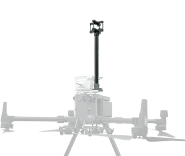
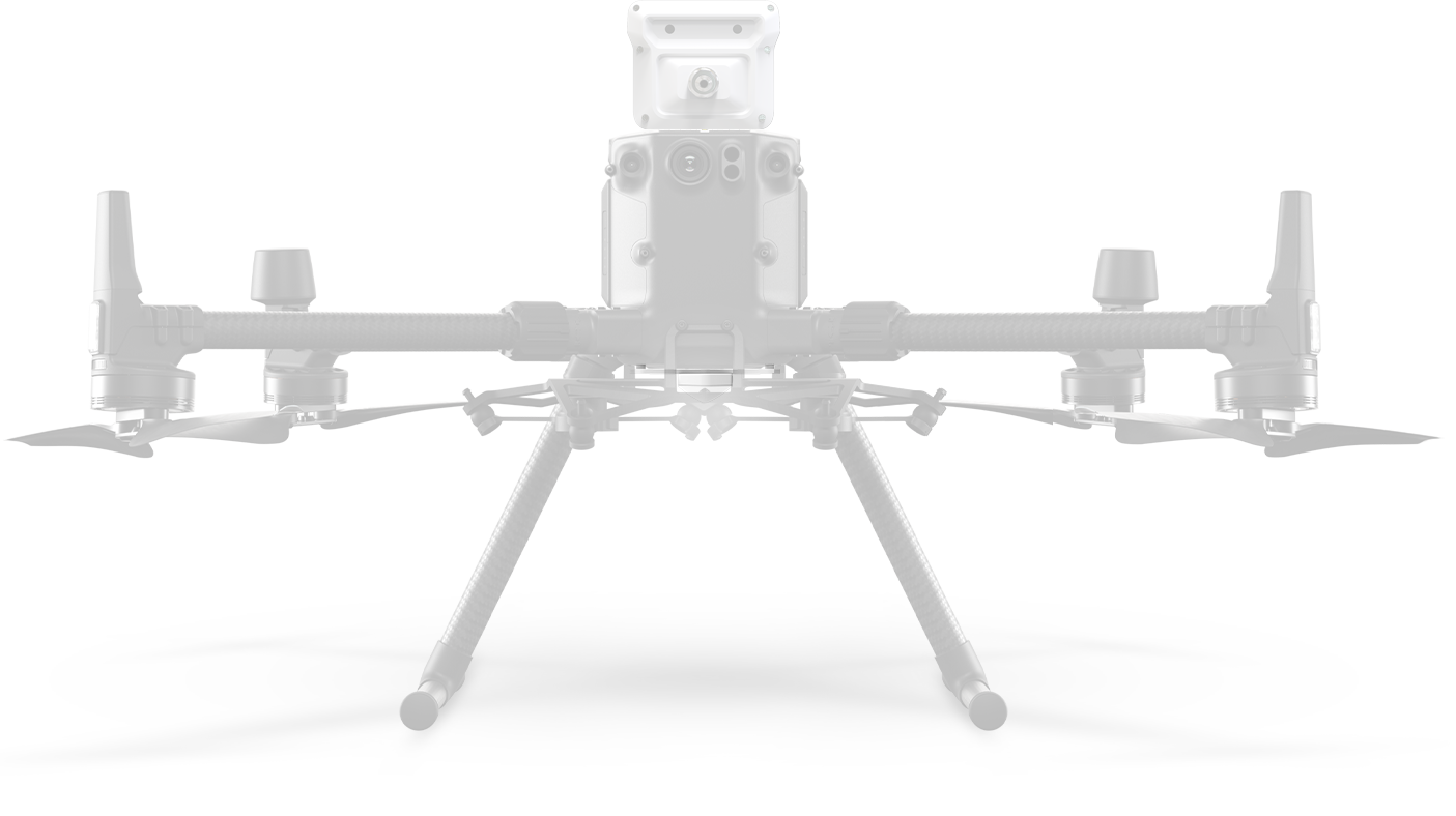
M300 RTK
With a flying time up to 55min, level 7 wind resistance, IP45 rated water resistance, the drone makes sure to work under severe weather depending on its long-enduring battery life and stable system.
The intelligent tracking and the advanced double-control module provide convenience and bring efficiency for the maritime crew.
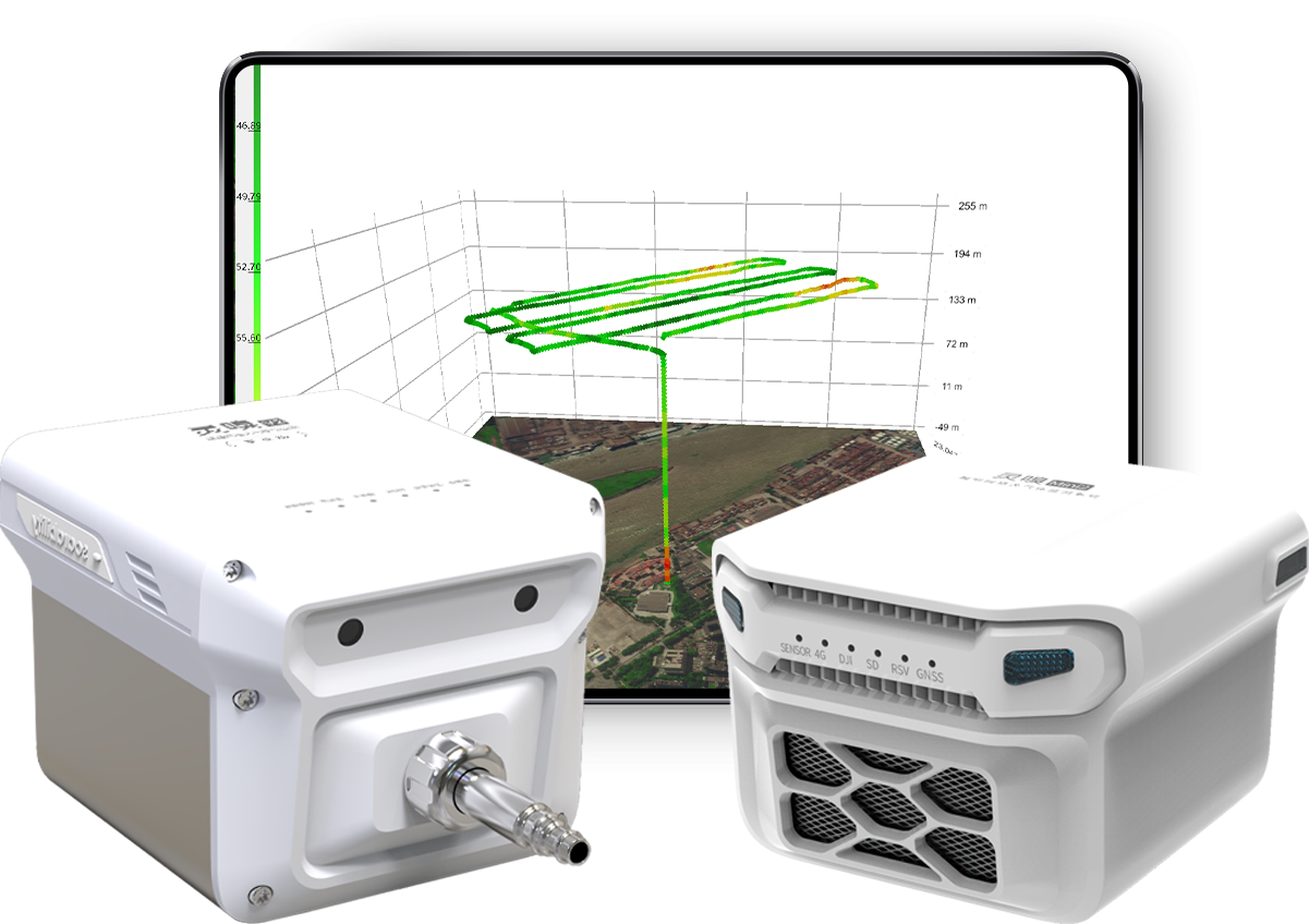
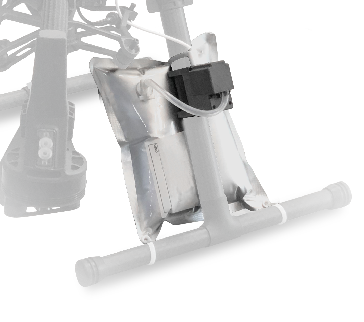
H20T+Sniffer4D V2
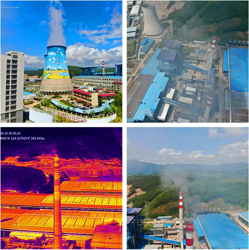
H20T contains a 20mega pixels of maximum 200X zoom camera, providing better concealment when capturing pictures or videos from a long distance or high altitude.
H20T is equipped with a 640X512, 30Hz thermal camera, and it can quickly discover the hidden emission vents through the distributions of thermodynamic diagram.
Sniffer4D V2 can sense up to 9 gas and particle concentrations at a time with high sensitivity and stability.

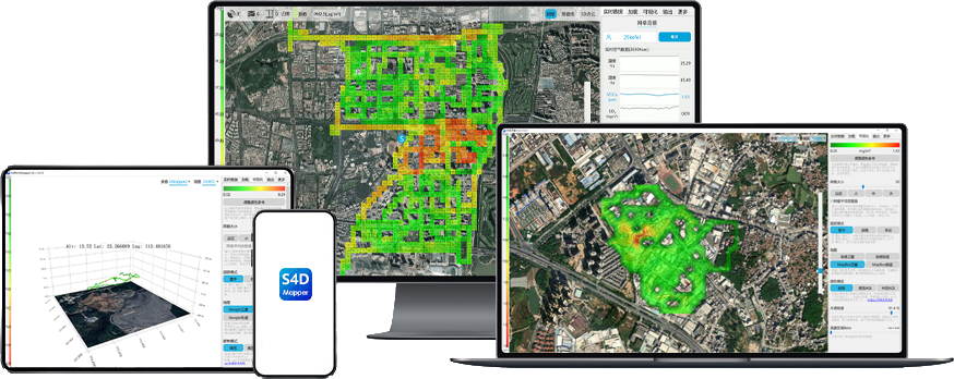
Software Configuration
DJI Terra
DJI Terra quickly and efficiently creates a 2D model of the industrial park to get the distributions of the factories and set up the monitoring route.
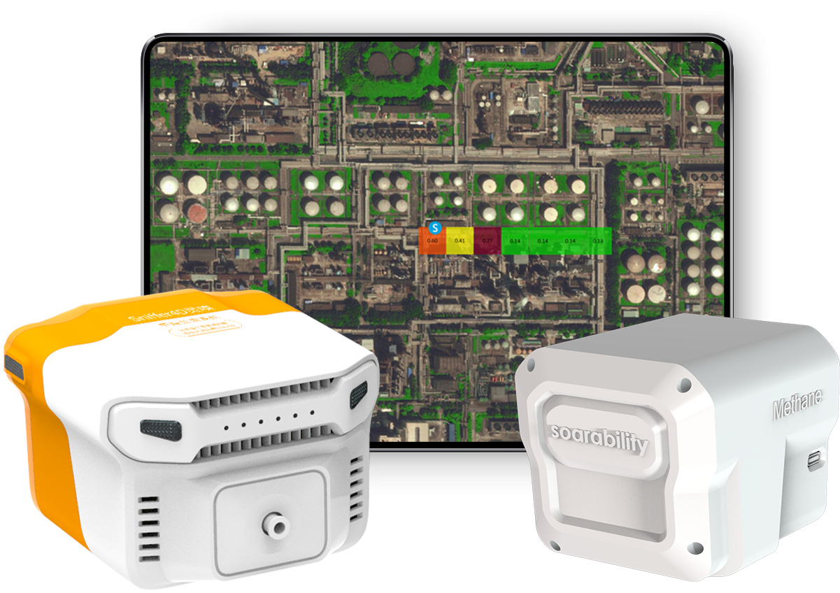
Sniffer4D Mapper
Sniffer4D Mapper is a professional and visualized analytical software that can quickly transmit the sampling data and display the gas concentrations in real-time. It snapshots and records the videos through the guides of real-time concentrations to provide evidence for law enforcement.
Making Monitoring Plan
The combination of M300 RTK and H20T quickly scanned and created a 2D model of the industrial park, then the inspection crew assigned multi-time and multi-dimensional monitoring missions according to the distributions of the factories. The inspections were conducted individually in the morning, afternoon and evening.
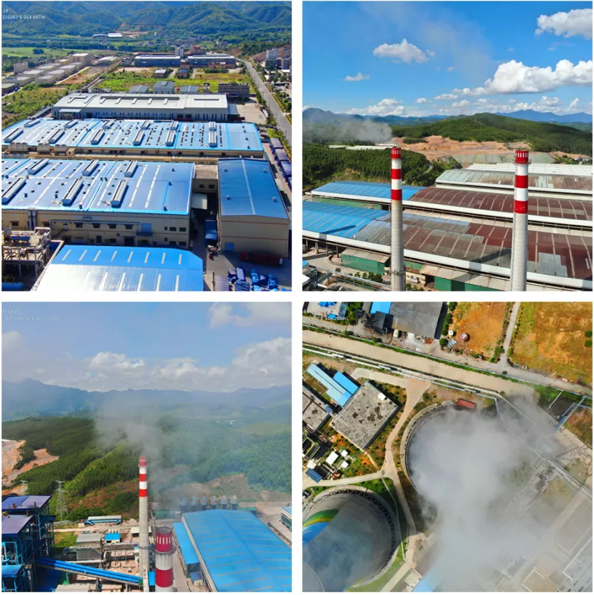
On the Set
The inspection crew operated the drone to quickly scan the pollution emission above the industrial park and searched for the suspicious emission vents through the infrared thermal images. The investigation focused on the living areas and schools located within 5km from the industrial park and its downwind area. Sniffer4D transmitted the real-time concentrations of VOCs, PM2.5, PM10, NO2, SO2, CO, O3, H2S, NH3 to the ground end and revealed that the concentrations of PM2.5, PM10, NO2, SO2 were extremely high.
Considering the fact that some factories may secretly emit the gases at night, we decided to conduct the inspection at night as well. Based on the location information of the industrial park and nearby living areas, we planned the inspection route for the drone and collected data along the wind direction. Meanwhile, the visualized analytical software Sniffer4D Mapper showed the real-time gas concentration distributions, and it revealed the abnormal SO2 concentration in the school area within 2km from the industrial park.
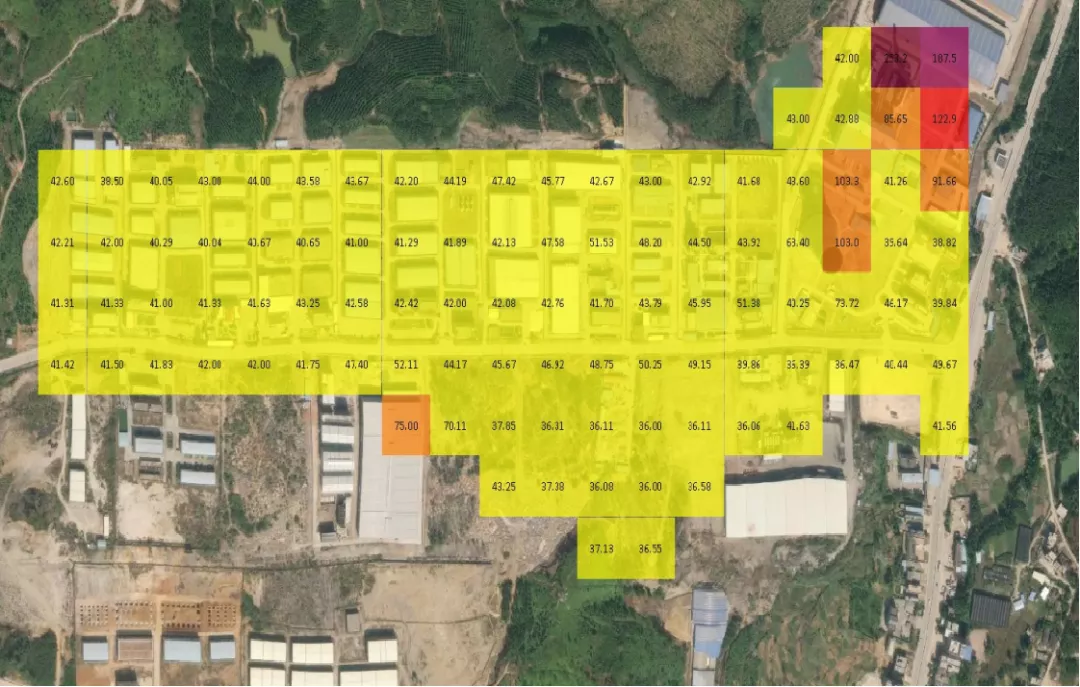
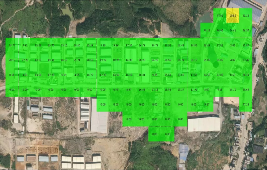
PM10 Concentration Distribution
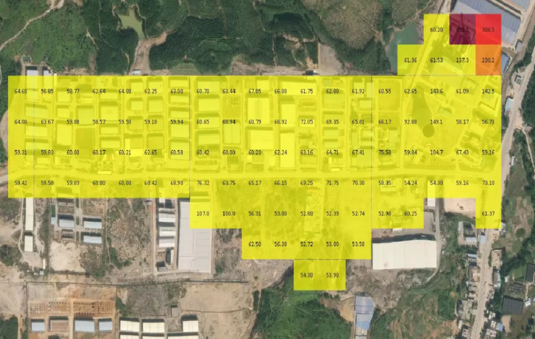
The 2D grid map showed the PM10 concentration at a glance, and the pollution was significantly severe near the chimney.

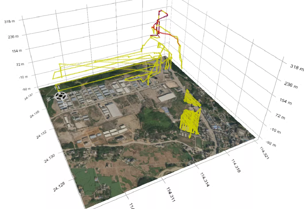
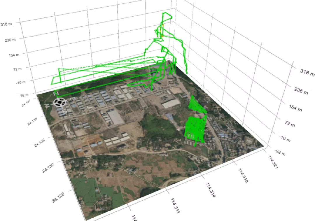
The 3D cloud point map showed that the PM10 concentration is distributed near the chimney,
and the pollution was significantly severe at an altitude of 150-230m.
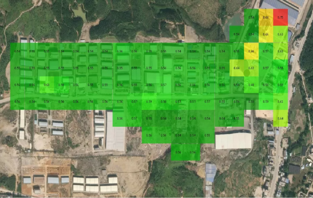
PM2.5 Concentration Distribution
The 2D grid map showed the PM2.5 concentration at a glance, and the pollution was significantly severe near the chimney.
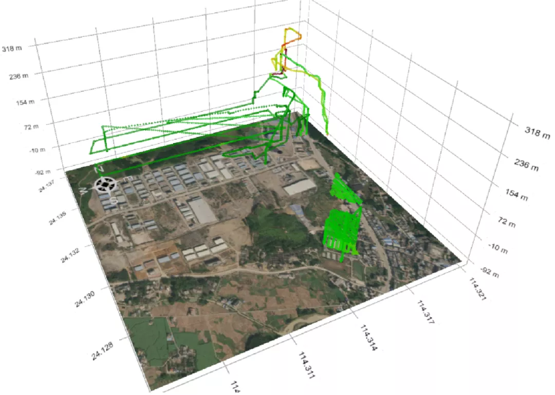
The 3D cloud point map showed that the PM2.5 concentration is distributed near the chimney,
and the pollution was significantly severe at an altitude of 150-230m.
SO2 Concentration Distribution
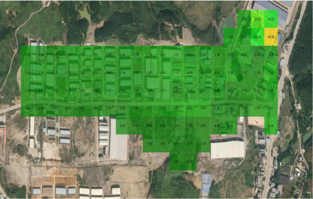
The 2D grid map showed the abnormal SO2 concentration distribution around the chimney.
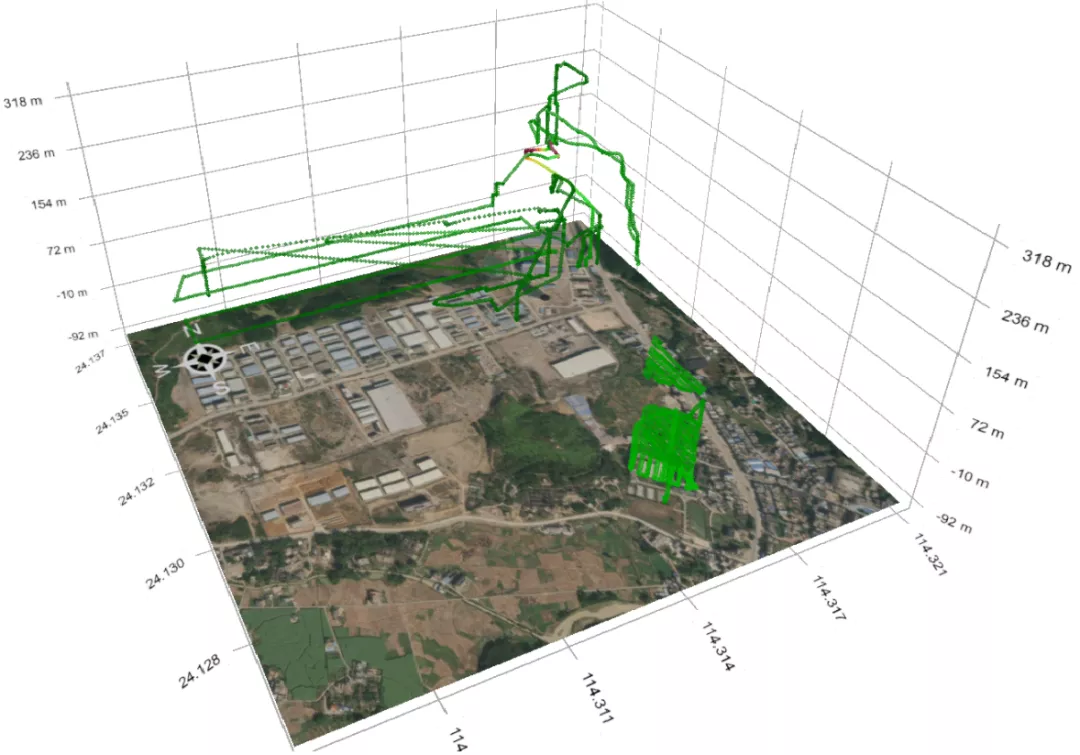
The 3D cloud point map showed no abnormalities of SO2 concentration near the ground,
and it detected the abnormal concentration when the drone lifted to 75m in the air.
NO2 Concentration Distribution
The 2D grid map showed the abnormal NO2 concentration distribution around the chimney.
The 3D cloud point map showed no abnormalities of NO2 concentration near the ground,
and it detected the abnormal concentration when the drone lifted to 75m and 154m in the air.
VOCs Concentration Distributions
The 2D grid map showed the abnormal VOCs concentration distributions around 50m from the chimney.
The 3D cloud point map showed no abnormalities of VOCs concentrations near the ground,
and it detected the abnormal concentrations when the drone lifted between 75m and 263m in the air.
H2S Concentration Distribution
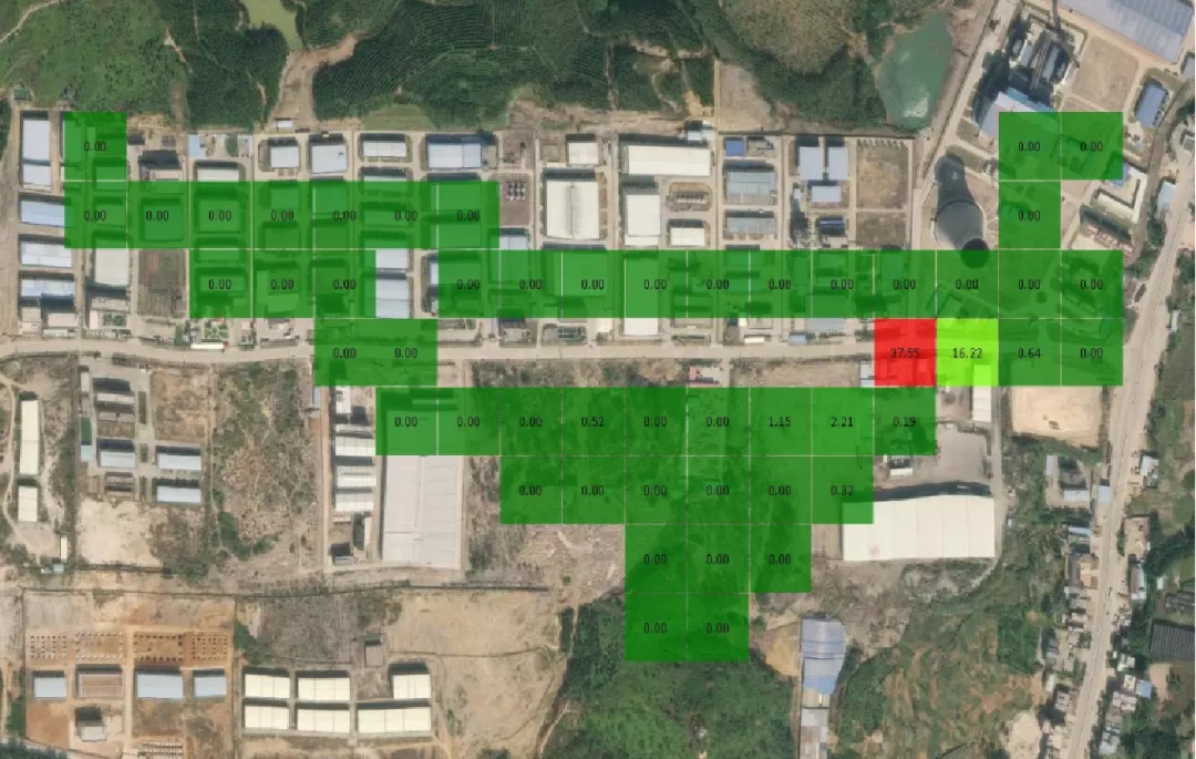
The 2D grid map showed the abnormal H2S concentration distribution around 50m from the chimney.
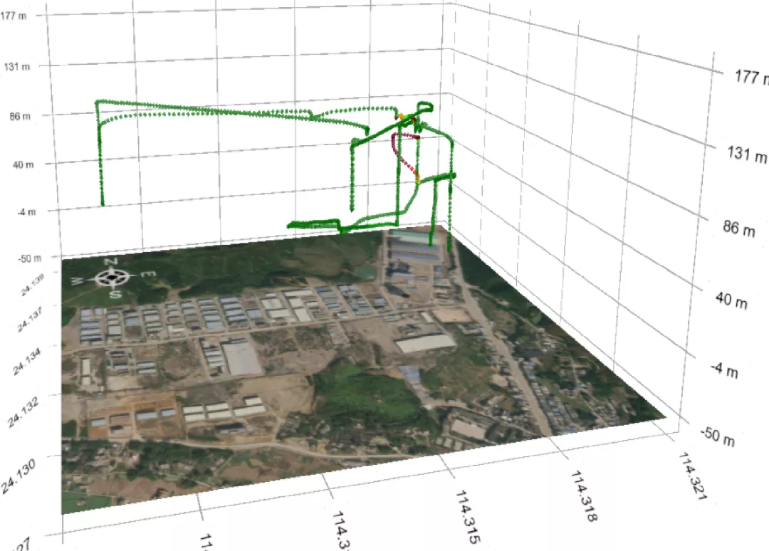
The 3D cloud point map showed no abnormalities of H2S concentration near the ground,
and it detected the abnormal concentration when the drone lifted to 40m in the air.
The Solution
The integration of Drone, Sniffer4D multi-gas detection system and HD/thermal camera
· Quickly locating the pollution sources: Through low-altitude inspection, it quickly detects and collects the
pollution distributions above the industrial park, the emissions vents and around the dangerous areas.
· Providing evidence for law enforcement: It is equipped with an HD lens and thermal camera for real-time monitoring,
picture taking and video recording to identify hidden covert production activities and night activities.
· Accurate GPS localization: It provides accurate longitude, latitude, height and time lamps for the target location and
the image of each gas pollution.
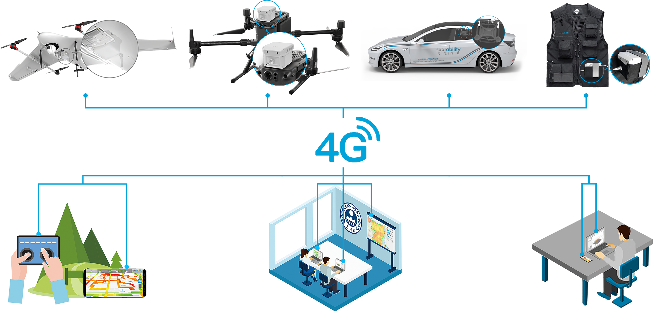
· Data Transmission: Real-time with no distance limit.
· One to Many: Both on-site live monitoring and remote monitoring at the same time.
· Many to One: Support multiple drones being monitored by one end.
· Many to Many: When multiple drones are connected to multiple monitoring ends, each end has the access to
monitor all the data in real-time.
· Complete data: The advanced data retrieval algorithm can retrieve the data if there is a signal interruption and the SD
card will automatically backup the data.
Anyway, the drone-mounted Sniffer4D multi-gas detection system has obvious advantages compared to the traditional monitoring method: